Affiliate links on Android Authority may earn us a commission. Learn more.
How to create your own map in Google Maps
Published onJune 22, 2022
Google Maps does a decent job of getting you from point A to point B. But what if you have many destinations in mind along your journey? Thankfully, you can create your own map with multiple stops, routes, terrains, and more using Google Maps. Here’s how to create a custom map in Google Maps.
Read more: How to drop a pin on Google Maps
QUICK ANSWER
From the Menu in Google Maps, navigate to Your Places, select Maps, and then click Create Map at the bottom of the list. A new page will open to create your custom map.
JUMP TO KEY SECTIONS
Creating a Custom Map in Google Maps
You’ll need to use Google Maps on your desktop to create a custom map. However, once completed, you can view your custom map on the Android or iOS apps.
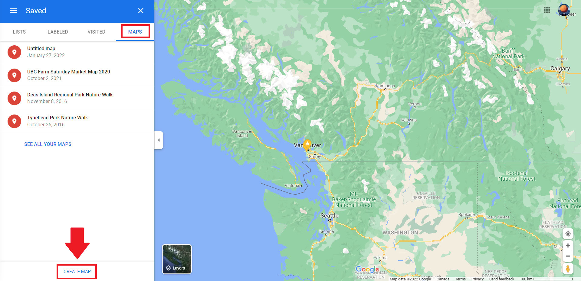
To start, click open the Menu in the top left corner of the screen and click Your Places. From there, select Maps on the far right tab and then click Create Map at the bottom of the list. This will bring you to a new page to create your custom map.
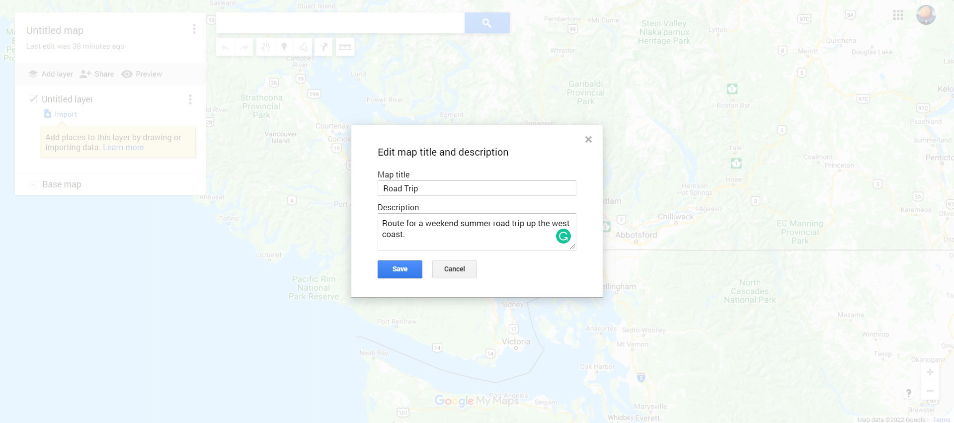
Start by giving your map a name. Click where it says Untitled map in the upper-left box to open the Edit map title and description menu. Add a name and description for your map, and then click Save.
Next, select the theme for your base map. Different themes can be helpful for various purposes. For example, it might be beneficial to have a terrain layout for hiking routes, while planning a road trip might be more precise with a basic Map or a Simple Atlas theme.
Click the downwards-pointing arrow beside Base Map to choose your preferred theme.
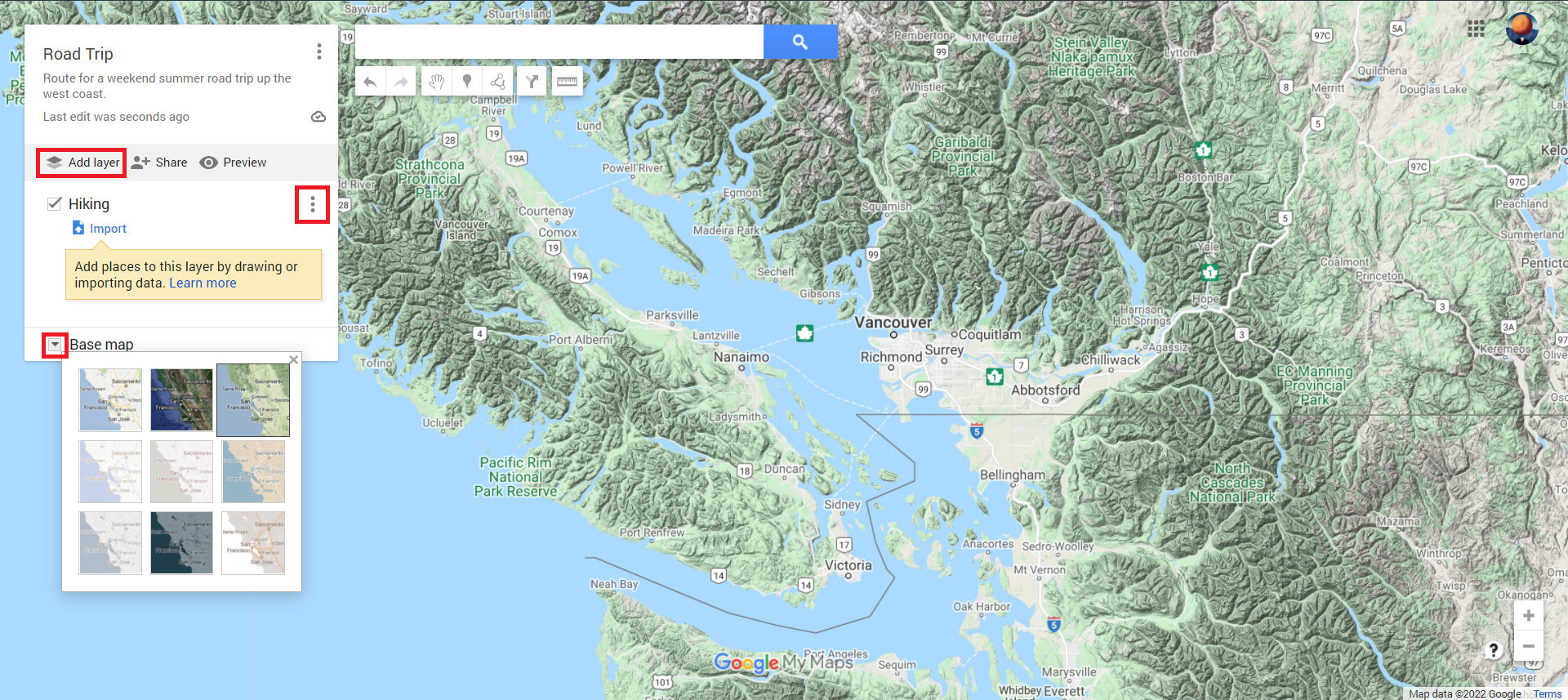
Additionally, your custom map can be composed of multiple layers, each with unique details and destinations. You can add more layers by clicking Add layer in the top greyed-out bar and remove or rename layers by clicking the three dots beside its title.
Adding Elements to a Custom Map in Google Maps
Now that we’ve named our map and layers and have selected a theme, it’s time to add some details. You can add marker points, shapes, distance lines, and directions directly onto the map or its layers.
Pins
Pins help mark specific locations with unique descriptions. You can search for a place in the search bar or find it on the map by clicking, dragging, and zooming in with your mouse or trackpad. Click the Add marker button below the search bar to pinpoint a spot. Give your pin a title and description, and then click Save.
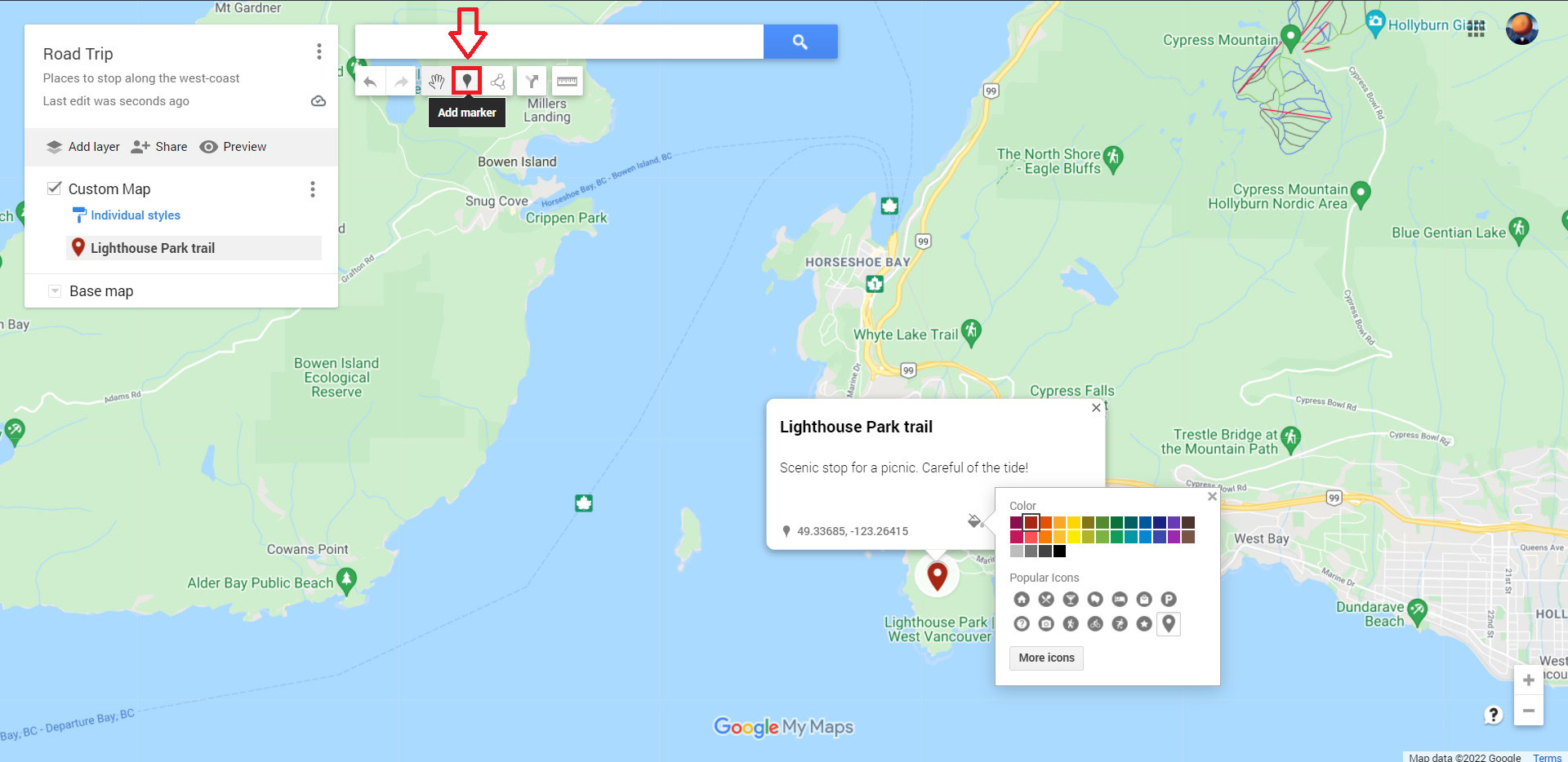
From there, you can customize the pin’s icon image color or add photos of your time there. You can add as many custom pins to your map as you like.
To see the details of your different pins and any other elements, click Select items, represented as a hand icon beside the Add marker icon.
Directions
Click the Directions to here icon under your destinations pin to create a new layer with directions between your pins.
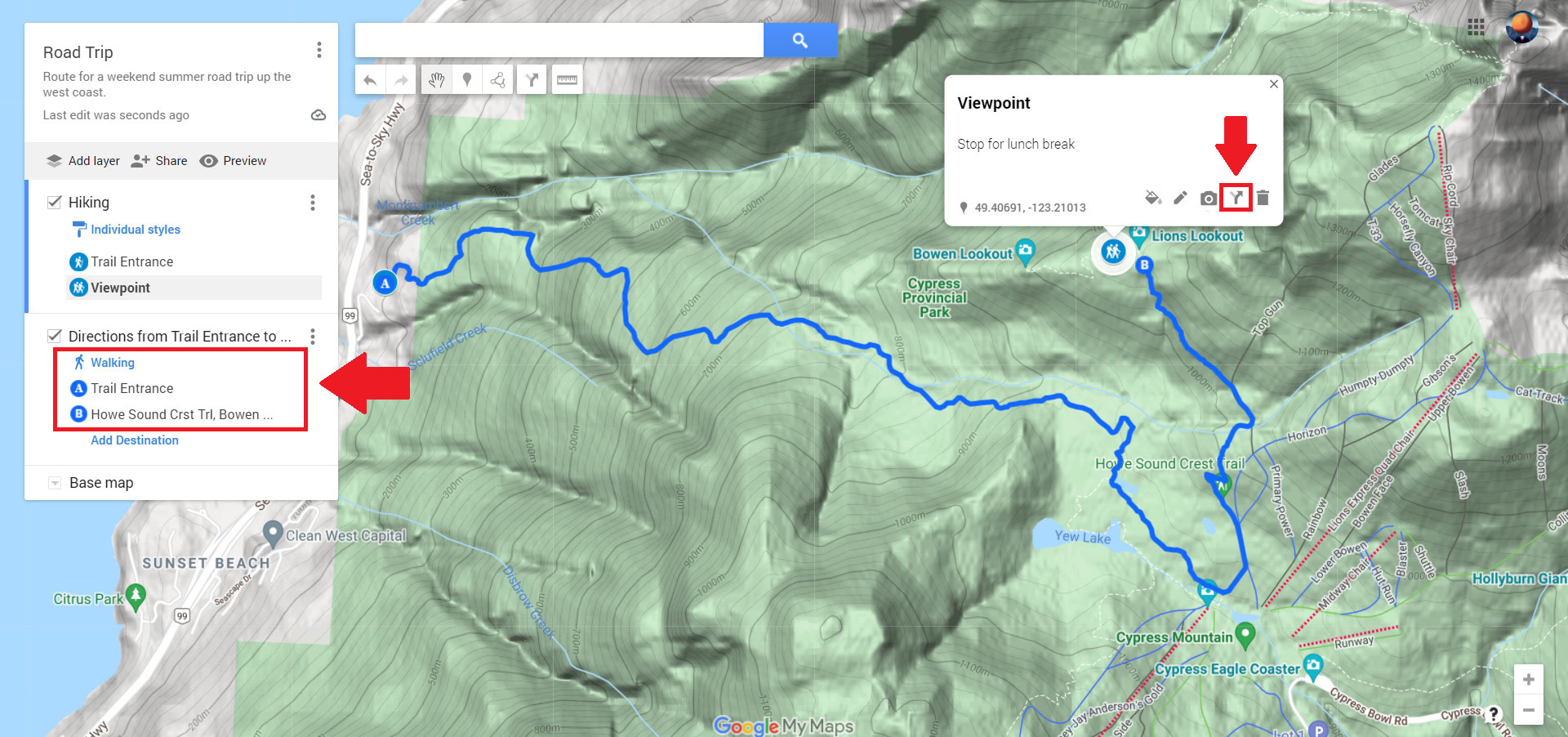
Next, select your method of transportation under the new layer’s name and type in the name of another pin as your A starting point. Google will now plot a path between your pins.
Lines and Shapes
Adding lines or shapes to your map can help emphasize certain regions. Click the Draw a line icon beneath the search bar to do so. Then, draw lines using your mouse or trackpad to create a joined-up shape. If you ever make a mistake, you can click the Undo or Redo buttons beneath the search bar to start over.
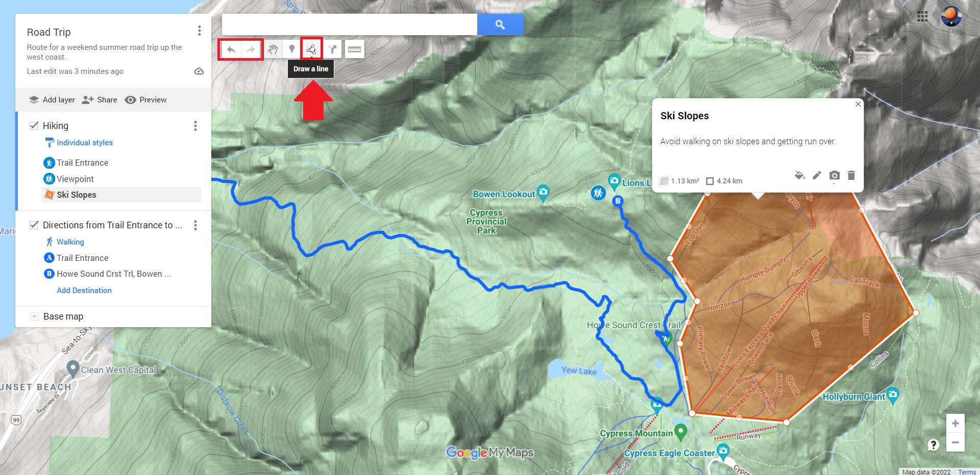
Give your shape a name and description, then Save it to your layer. The area of your shape will automatically be calculated, and you can customize the color and opacity and add photos to your shapes.
Measuring Distance
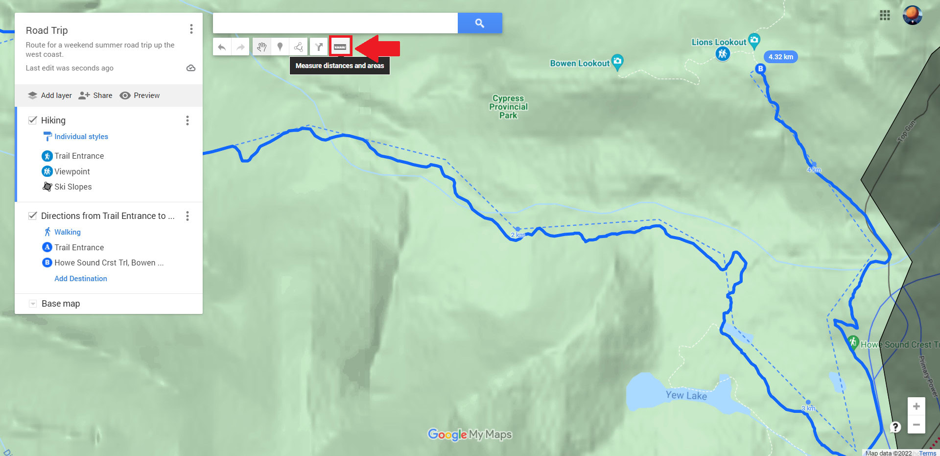
You can measure the distance of your journey to better plan ahead. Click Measure distances and areas, represented by the ruler icon beneath the search bar. You can now draw lines with each click, and Google will give you the distance between points.
Note that all the changes you make to a custom map are saved automatically to your Google account, so don’t worry about losing your progress. You can find your custom maps under the Maps tab of Your Places, where this guide started.
Sharing a Custom Map in Google Maps
Once you’re done editing your custom map, you can share it with others so you’re all on the same page. Head to the Google My Maps website, sign in, and select the Owned tab to share a map. Your custom map should be listed here.
Click the Share Map button on your custom map. This will give you options to share your custom map on Facebook or Twitter, through email, or by embedding it on your website.

You can also create a custom link to your map to share it with others directly.
Click on your custom map in the Owned tab of the Google My Maps website to the map editor. From there, click the Share button in the left-hand menu.
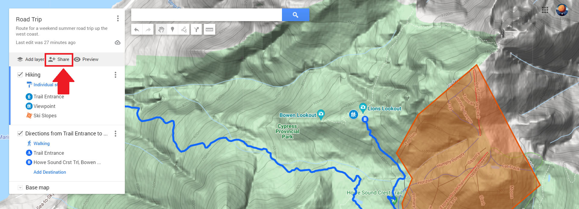
This will bring up the Share settings. From here, enable the top slider so that anyone with the link can view your custom map.
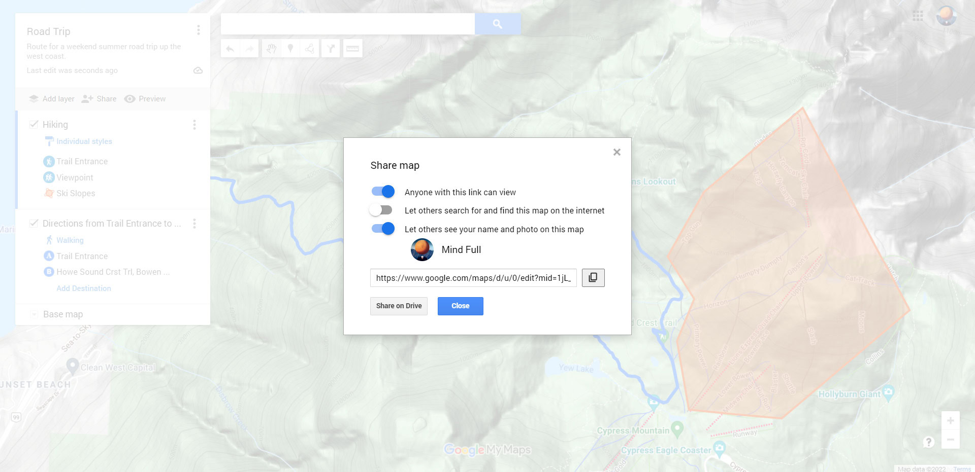
Now, all that’s left to do is copy your custom link to share it with others through your messenger of choice.
Read more: How to use Google Maps offline
FAQs
Yes, but you will have to grant them editing permissions. Otherwise, those you share your custom map with will be in the map viewer. While in the map viewer, they can still:
- Search the map contents
- Show or hide layers
- View the map with satellite imagery
- Share, export, and print the map
If you own a map and want to see how it looks in the map viewer, click Preview in the left-hand menu.
You don’t need to create a custom map to find bus routes. Open Google Maps and select your destination. Select Directions, then select Transit to view available bus routes and times.
You can create a custom map to detail a running route in Google Maps. Use the Directions feature to trace a walking route and use the Measuring tool to calculate the distance traveled. Your custom map will be saved to your Google account if you need to reference it on your mobile device while out for a run.
Creatong a custom map is a great way to create a travel plan for your trip. See our guide on how to plan a road trip with Google Maps for more details.