Affiliate links on Android Authority may earn us a commission. Learn more.
How to see Street View on Google Maps
Published onOctober 12, 2022
Did you know it’s possible to have a first-person point of view of various places worldwide on Google Maps? With Street View, you can explore landmarks, see natural wonders, and virtually step inside museums, arenas, restaurants, or small businesses. You can even view street-level imagery from the past to see how your neighborhood has changed over time. Here’s how to see street view on Google Maps.
Read more: How to find elevation in Google Maps
QUICK ANSWER
On the desktop, drag and drop the yellow Pegman in the bottom right-hand corner to a place on the map. On the mobile app, tap on a location's pin, then tap the image with the Street View icon. Or tap Layers--> Street View.
KEY SECTIONS
How to see Street View in Google Maps (desktop)
First, search for a place or address you’d like to explore on Google Maps.
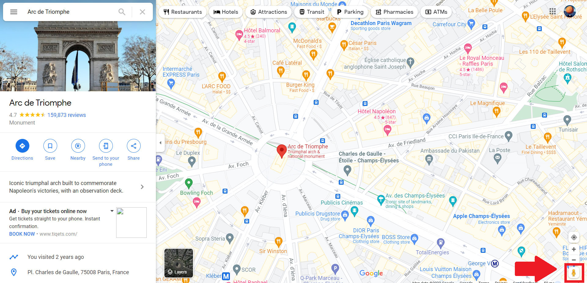
In the bottom right of the screen, you’ll find Pegman, your friend, for exploring Street View. Click and hold him to pick him up, then drag and drop him to the area you want to explore. You can drop Pegman on a blue line or blue dot on the map, as these are areas where Google or other Google Maps users have taken street-level photos.
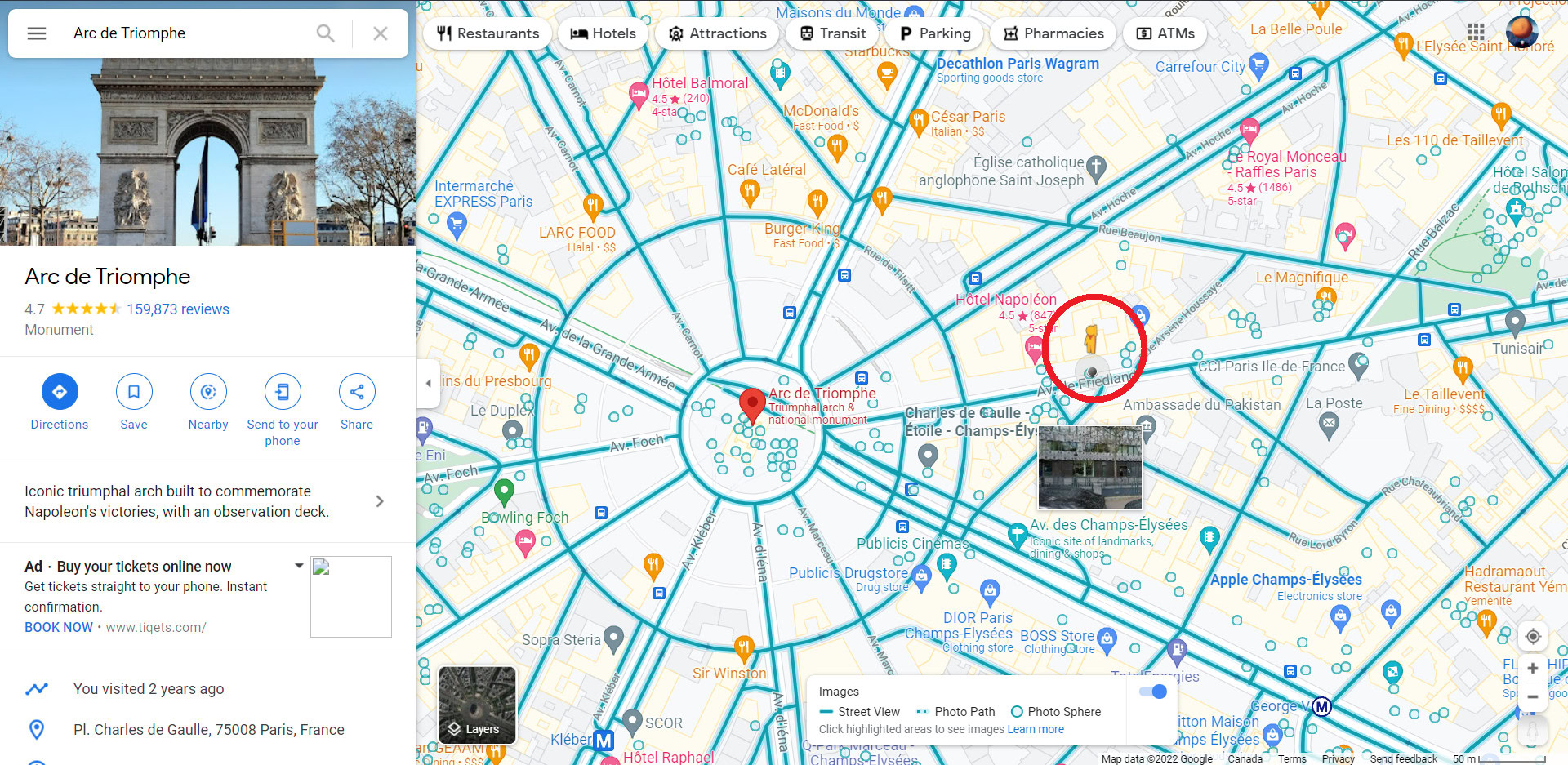
Explore Street View
To move around in Street View, hover your cursor in the direction you want to go. You’ll notice your cursor becomes an arrow along the ground and indicates which direction you’re moving.
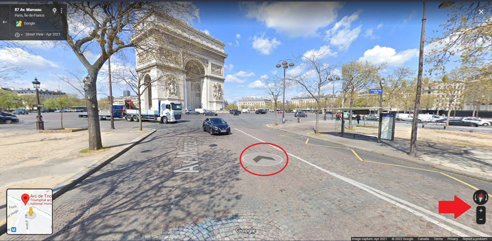
You can look around by clicking and dragging your mouse. You can also use the arrows to the left and right of the compass icon. Use your mouse or touchpad to zoom in or out to get a closer look. You can also use the plus and minus buttons below the compass. You can always orient yourself to face north by clicking the compass in the bottom right corner if you get turned around.
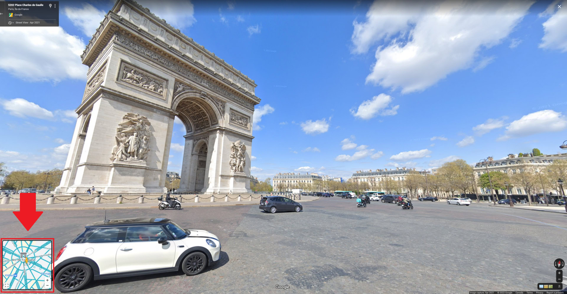
To jump between streets faster, hover over the Back to Map window in the bottom left and click the blue highlighted routes.
See street-level imagery from the past
You can travel back in time to see older street-level imagery from the Street View’s archives on Google Maps. However, don’t expect to see anything before the industrial age since most areas only date back to when Google first introduced Street View in 2007.
To change the timeline, drag the Pegman onto the map, and once dropped, click Time, represented by a clock icon, in the upper left corner. Then, use the slider to go forward or back in time.
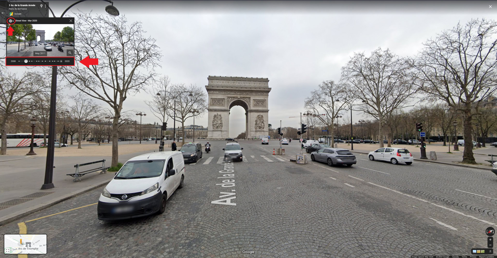
To exit Street View, click the X icon in the upper right corner.
How to see Street View on the Google Maps app
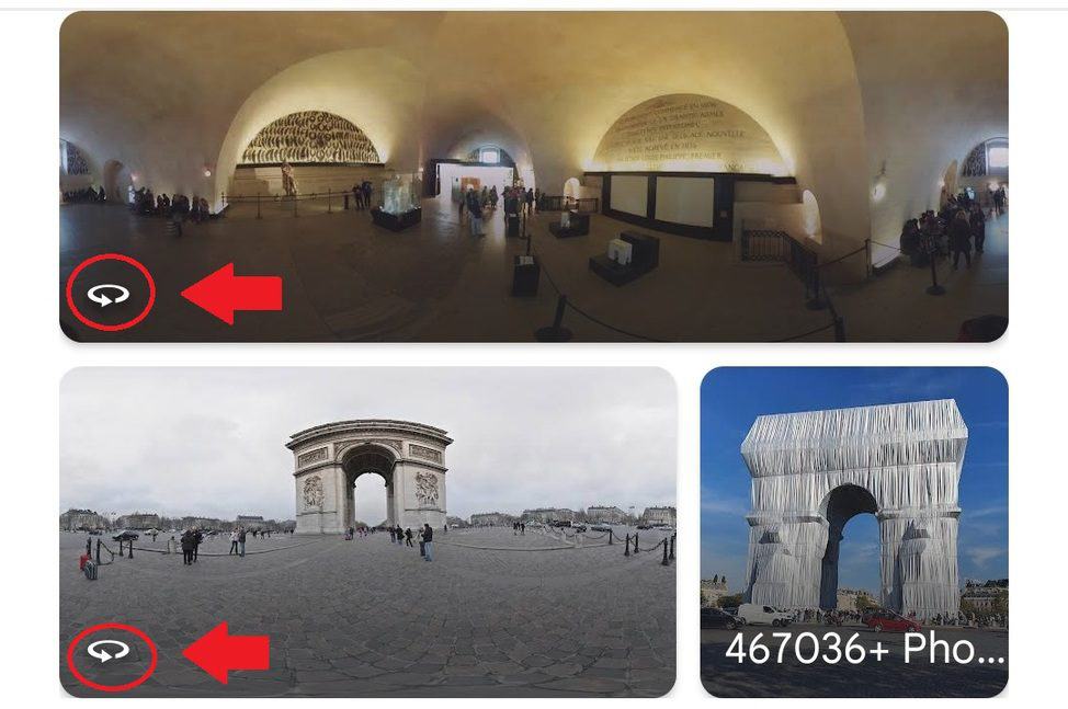
There are two ways to see Street View on the Google Maps app. You can search for a place, drop a pin, or tap on a place marker to view the location description. From there, scroll down and select the photo labeled Street View or the thumbnail with a Street View 360 icon.
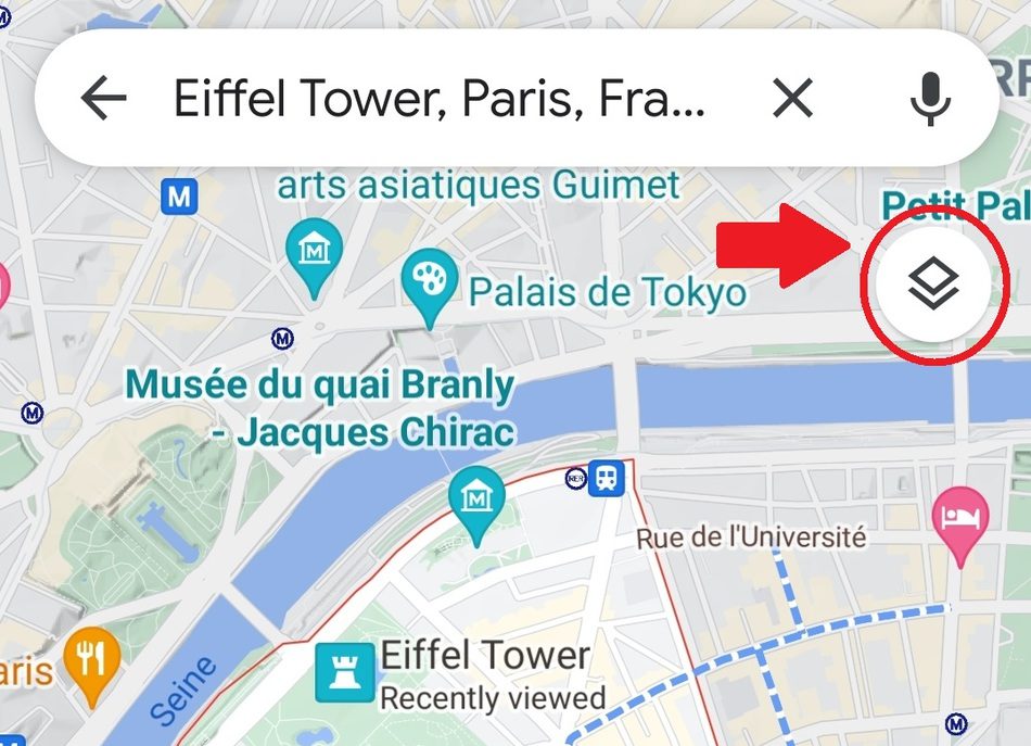
Alternatively, you can tap the Layers icon In the upper left corner.
Then, tap on the Street View icon with Pegman.
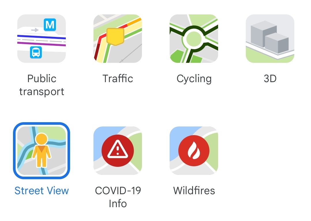
You can tap on any blue line to enter Street View. Blue lines on the map indicate Street View coverage.
Explore Street View on mobile
To look around in Street View, drag your finger on the screen or tap the compass. Then, move around by tapping the arrows or double-tapping the image in the direction you want to go. Or tap any blue line on the smaller map to teleport there.
If you tap any named point of interest on the smaller map, the map immediately re-centers with new imagery for the best view of that place.
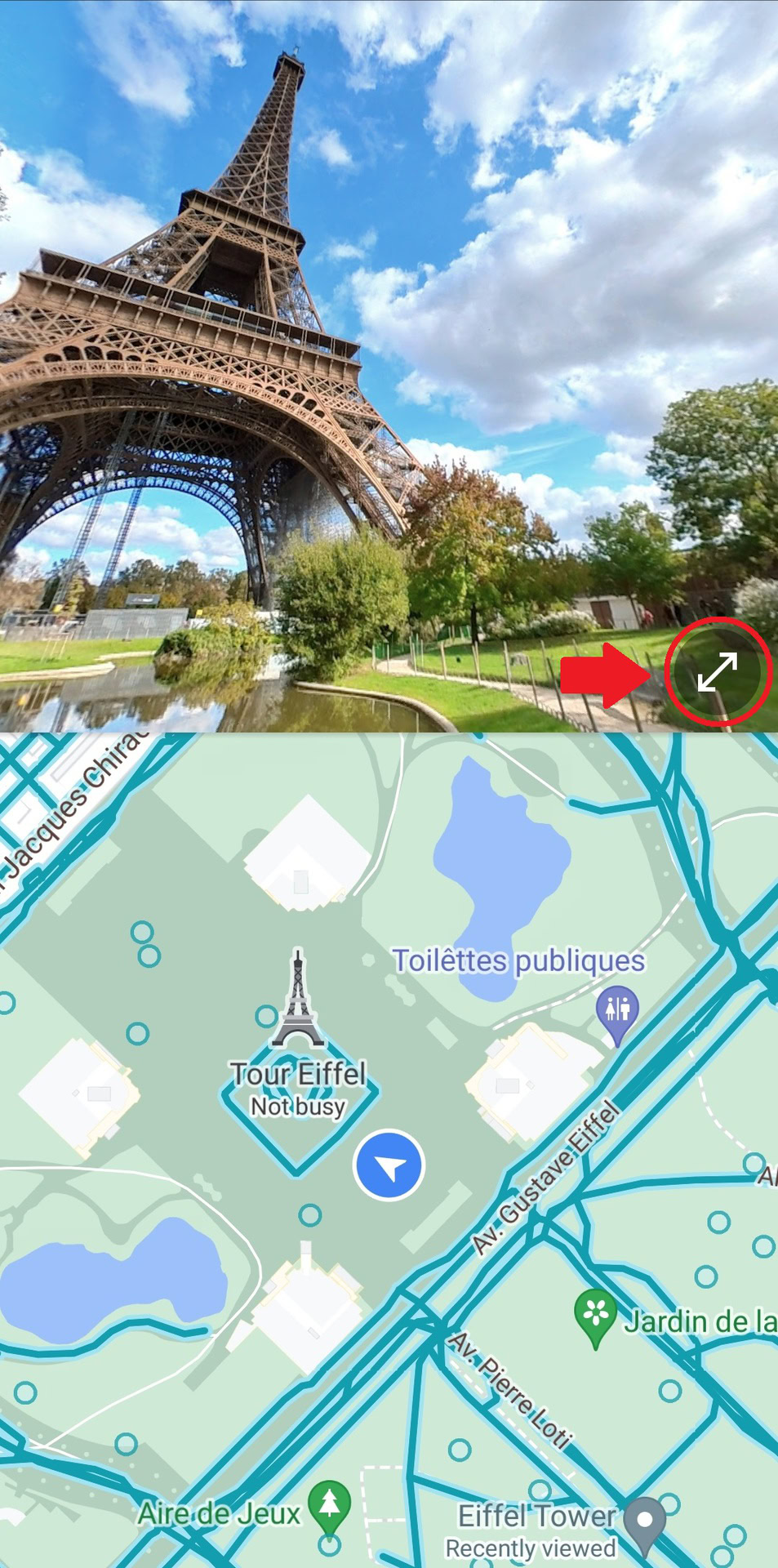
Switch from a full-screen Street View image to a split-screen view that displays a small map by tapping the arrows in the bottom right of the street view image.
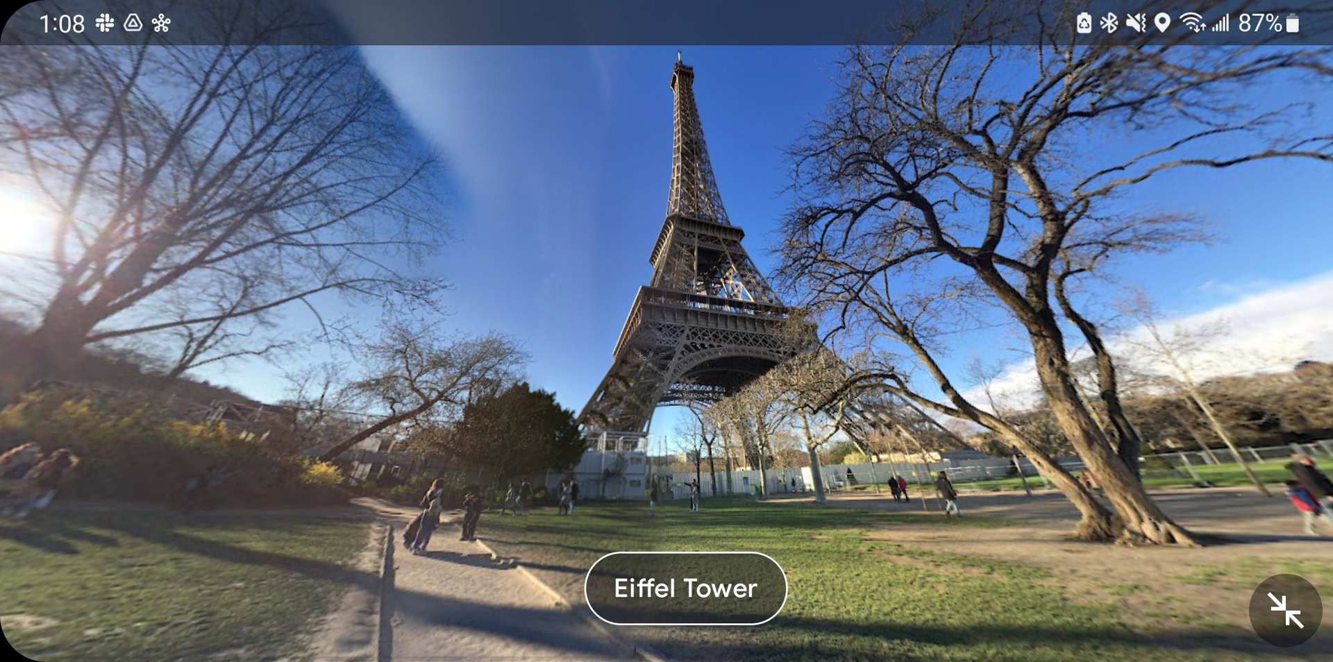
You can also see a wider view and change to landscape mode by turning your device sideways. To zoom in, pinch open on the screen, and to zoom out, pinch closed on the screen.
Read more: How to save a location in Google Maps
FAQs
Street View and other real-life maps tend to update every few years. You can view when a street-view image was last updated via the image capture information in the bottom right of the screen.
Transparency builds trust. Instead of telling customers where you are, you can show them by letting them visually explore the surrounding area of your business. This can help them make informed decisions, such as finding parking. You can also show off the interior decor of your business to better connect with a target audience. Overall, Street View provides a convenient and comfortable experience to today’s consumers. As they say, pictures speak louder than words.
To report an image that should be censored or which are potentially offensive:
- Locate the image.
- Click More, represented by three dots, and then click Report a problem.
- Select the issue and click Submit. Google will then review your report.
Not until recently; Google launched a standalone Street View app to celebrate the 15th anniversary of the street view feature. You can even time travel on Street View, viewing what different areas looked like each time the Street View car drove past!