Affiliate links on Android Authority may earn us a commission. Learn more.
Google Maps is gaining real-time transit info in two new countries and four new metro areas
Published onJune 2, 2015

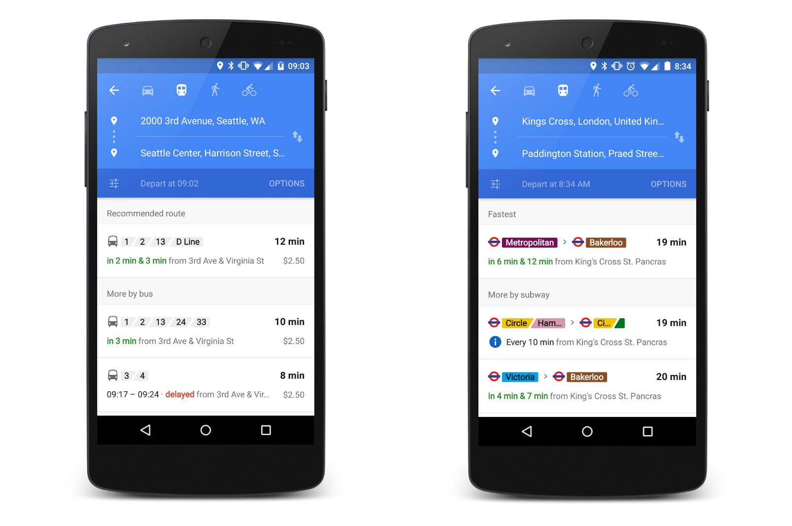
If you’ve ever missed a bus or a train, you’d know that it can make for a hectic and stressful situation. If that ever happens to you again, today’s Google Maps update might help you get through it with ease. In a new version rolling out now, Maps will display your relevant journeys, allowing you to easily see how long you’ll be waiting for the next train to arrive and what your alternate options are if you miss your bus. Check out the first image above to see what the new route summaries will look like.
Google has also announced that Maps is gaining real-time transit information in two new countries and four new metro areas. The company already works with over 100 partners to bring users this functionality, but now Google is adding more than 25 new partners to the lineup in six new places: U.K., Netherlands, Budapest, Chicago, San Francisco and Seattle. For those unfamiliar to the feature, real-time transit information allows you to see live arrival times for subways, buses and metros. It will also let you know if your route has been canceled.
All of these new features will be available to users sometime later today. Do you use Google Maps? If not, what navigation app do you use? Let us know in the comments!
