Affiliate links on Android Authority may earn us a commission. Learn more.
How to time travel in Google Street View
Published onMay 24, 2023
For over a decade, Google Street View has let users visually explore landscapes from the first-person point of view in over 100 countries and territories. That means users can travel back in time up to 16 years ago to see how places have changed. Google even has a dedicated Street View app to make it easy to feel nostalgic about your neighborhood right from your phone.
QUICK ANSWER
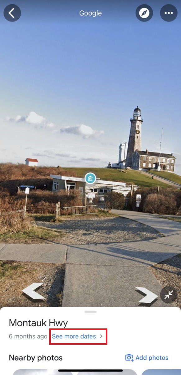
When viewing Street View imagery, tap on the photo to see information about the location. Then tap See more dates to see the historical imagery of that place, dating back to 2007.
KEY SECTIONS
What is Google Street View?
Google first launched Street View in 2007, and since then, it has accumulated 360-degree images of over 200 billion locations worldwide from multiple points in time. To celebrate its 15th anniversary, Google released more ways to explore historical imagery online and through a dedicated mobile app.
Google Street View compiles billions of images taken from Google and contributors to create interactive panoramas from positions along streets worldwide. Users use Street View to explore travel destinations, so they know what to expect, as well as world-famous landmarks, galleries, and museums right from their phones.
Additionally, as the topic of this article suggests, Street View users can turn the clock back with historical imagery to see how a location has changed over time.
How to time travel in Street View on the mobile app
When you select a location on Google Maps, you will see photos taken by users who have visited there or by Google itself. Any image with white turn-around arrows indicates it is a Stree View image.

When viewing Street View imagery of a place on Google Maps, tap anywhere on the photo to see information about the location.

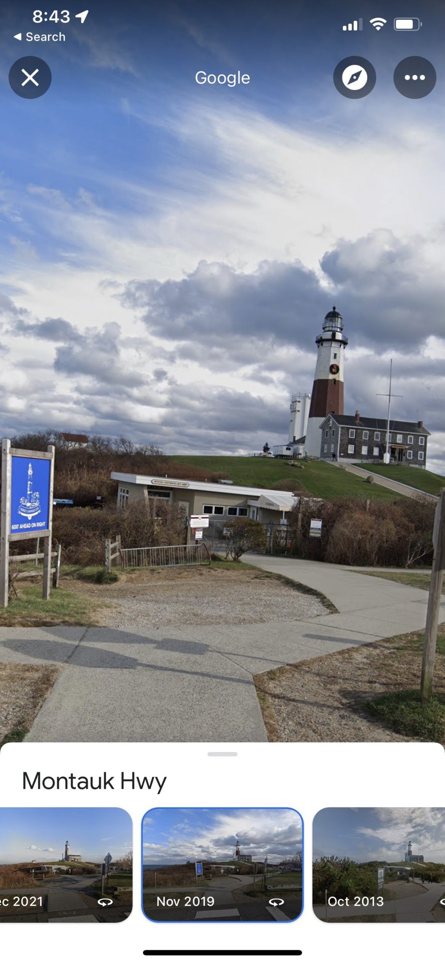
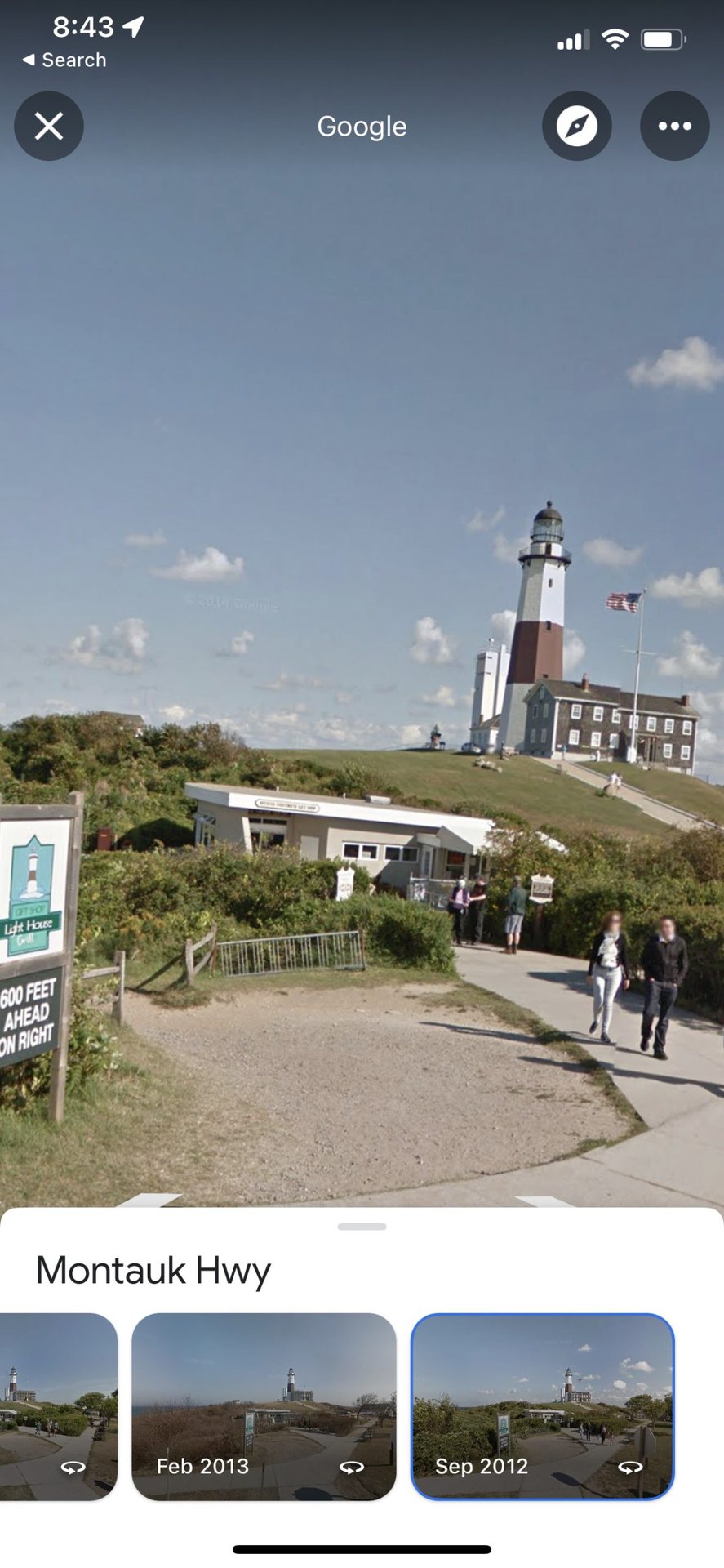
Then tap See more dates to see any past images that Google or others have published of that place.

Pictures will only date back to 2007, when Street View first launched. Scroll through to see a digital time capsule of how your favorite spot has changed over the years.

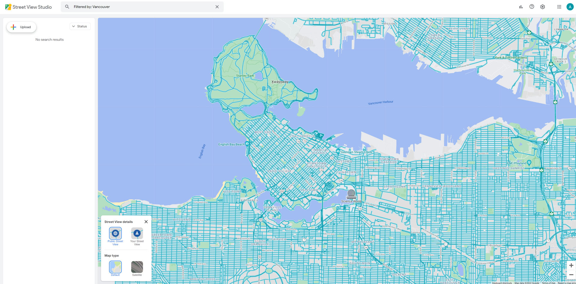
You can use the Street View Studio to upload your own Street View photos and contribute to the historical archives.

You can easily upload and manage your Street View content from the app. Upload 360 images in bulk, preview how content will look before uploading, and filter your content by filename and location to keep track of your photographs for years to come.
Some streets date farther back than others
While the earliest date you can see Street View imagery is from 2007, that doesn’t guarantee that every location will have images dating that far back or any historical images. For instance, the streets around Google’s headquarters in Mountain View, California, have the earliest Street View data from when the service first launched. However, Google added many cities in the following years, and much of the imagery from the late 2000s is lower resolution compared to Street View images taken today.

If you don’t see any images with white arrows on mobile or the clock icon on a desktop while in Street View, you’re looking at the only available images the Street View team has taken. If you’d like to fill in the gaps and contribute to Street View, get out there and take some photos to upload to Google Maps!
FAQs
Google tries to take new Street View photos in major cities once every year. However, given that anyone can now upload their own Street View images, locations will likely see an update more often.
On a desktop, click the clock icon in the upper left-hand portion of a Street View image and move the slider through time to see that same place in previous years or seasons. On the mobile app, select See more dates on the information page of a Street View image.
Privacy concerns have led to several countries around the world suspending Google Street View services. While people in these countries can still upload their own photos to Street View, the following countries do not allow Google itself to take Street View pictures:
- Austria
- Australia
- Germany
- India
- Canada
No, Google Street View is still available and has become an essential feature of Google Maps, providing users with panoramic images of streets worldwide.
You can find Street View in the Layers section of the Google Maps app.